With thousands of river and waterway crossings across the Firstgas network, checking submerged pipelines has always been an important part of our maintenance schedule.
In the past, it’s been a challenging undertaking, considered risky, time-consuming and providing only limited information. Thanks to new technology and a partnership with WSP, we can now survey waterways quickly, safely and with robust results.
We talk to Derek Coombe, Firstgas Pipeline Engineer, about how waterway monitoring has evolved over the years, and how a new remote-controlled vessel has delivered a safer, more accurate method.
Wading through rivers to monitor pipelines
Ropes, probes and waders: early survey methods
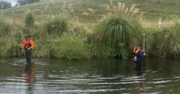
It’s vital to map our gas pipelines regularly and check what condition they’re in, even when the pipes run through waterways. Previously, Firstgas relied on manual survey techniques, as Coombe explains:
“In the early days, it was a person in waders with a rope tied around their waist, walking into the river with a probe. It was labour-intensive, risky, and the data didn’t always show what was really happening beneath the surface.”
Although data collection methods improved over the years, they still required people standing in the water, which meant that sometimes rivers were too deep, too fast-moving, or too murky to be monitored. Divers might have been used in deeper waterways and followed accepted practices at the time; they still carried inherent risk, Coombe says, but “we were limited by depth, flow and visibility. If a diver went under, you lost visibility immediately and control over their safety.”
One day, trying to map pipelines in the Waipa River, Coombe decided he’d had enough.
“The Waipa River was a real turning point for me. The current was strong, the willow trees created entanglement risks, and the logistics were huge. I had a real want to get people out of the waterway.”
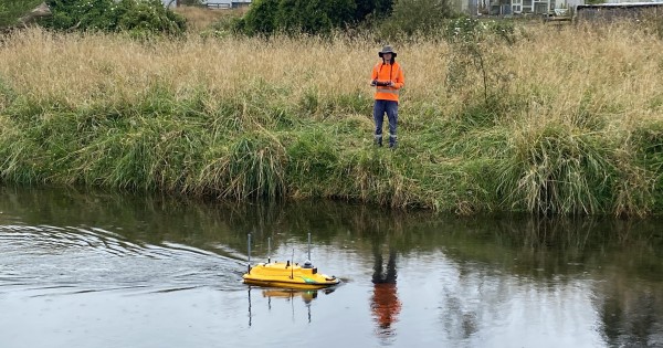
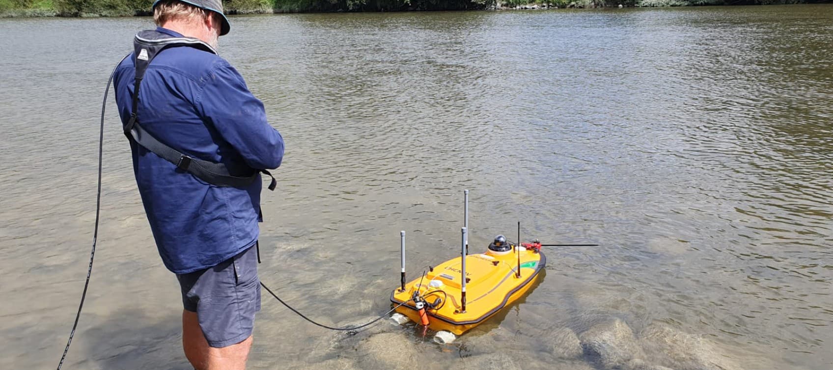
WSP remote control survey vessel carrying out inspection
From sonar-equipped kayaks to a New Zealand-first vessel
Working alongside global engineering firm WSP, the first step was trialling a single-beam sonar mounted on a modified kayak. This improved data quality considerably, but risks remained; the kayak method needed someone on the water and extensive safety controls.
Coombe recalls, “I was determined to keep people out of the water altogether, so I sent WSP a picture of a remote-controlled boat and asked, ‘How could we do this better?’”
WSP began investigating remote-controlled survey vessels as a safer alternative to traditional methods. The initial solution was a single-beam sonar boat equipped with GPS, survey instrumentation, a video camera, and radar.
As the first system of its kind in New Zealand, WSP needed to obtain Maritime New Zealand approval to operate in local waterways. This required the development of detailed operational procedures, along with specialised training for operators working across lakes, rivers, and ports in Aotearoa.
Building on this capability, WSP later expanded its fleet with a larger multibeam sonar vessel, further enhancing its remote survey capabilities in New Zealand.
Coombe says, “A survey that used to take four hours by kayak can now be done in about 30 minutes. You programme where you want it to go, push start, and the boat does the work.”
The small vessel is operated from the riverbank (so nobody needs to be in the water) and provides a wealth of detailed information. Multibeam sonar provides near-continuous riverbed surface modelling and identifies rocks, logs, buried assets, and any other debris. Combined with drone LiDAR data, Firstgas can now create 3D visualisations of its network, making it easier to identify potential issues and erosion.
“We’re getting confident data now,” says Coombe. “We’re identifying shallow pipe and erosion issues much earlier than we ever could before.” and able to undertake repeatable surveys for ongoing monitoring.
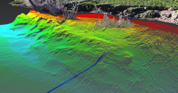
Monitoring data image collected by the survey vessel
“It doesn’t get much better than this”
The technology is now being used nationally and internationally, across a range of environments. It was recently used to map the Whanganui River in preparation for replacing the Dublin Street Bridge, with WSP team leader Peter Troon saying, “When it comes to underwater mapping, it doesn’t get much better than this.”
“WSP took a real risk bringing this technology into New Zealand,” Coombe adds. “They invested in it without any guarantee of work and it’s paid off for everyone. The biggest win for me is that we’re keeping people out of hazardous environments.”